Scalable Country Localization
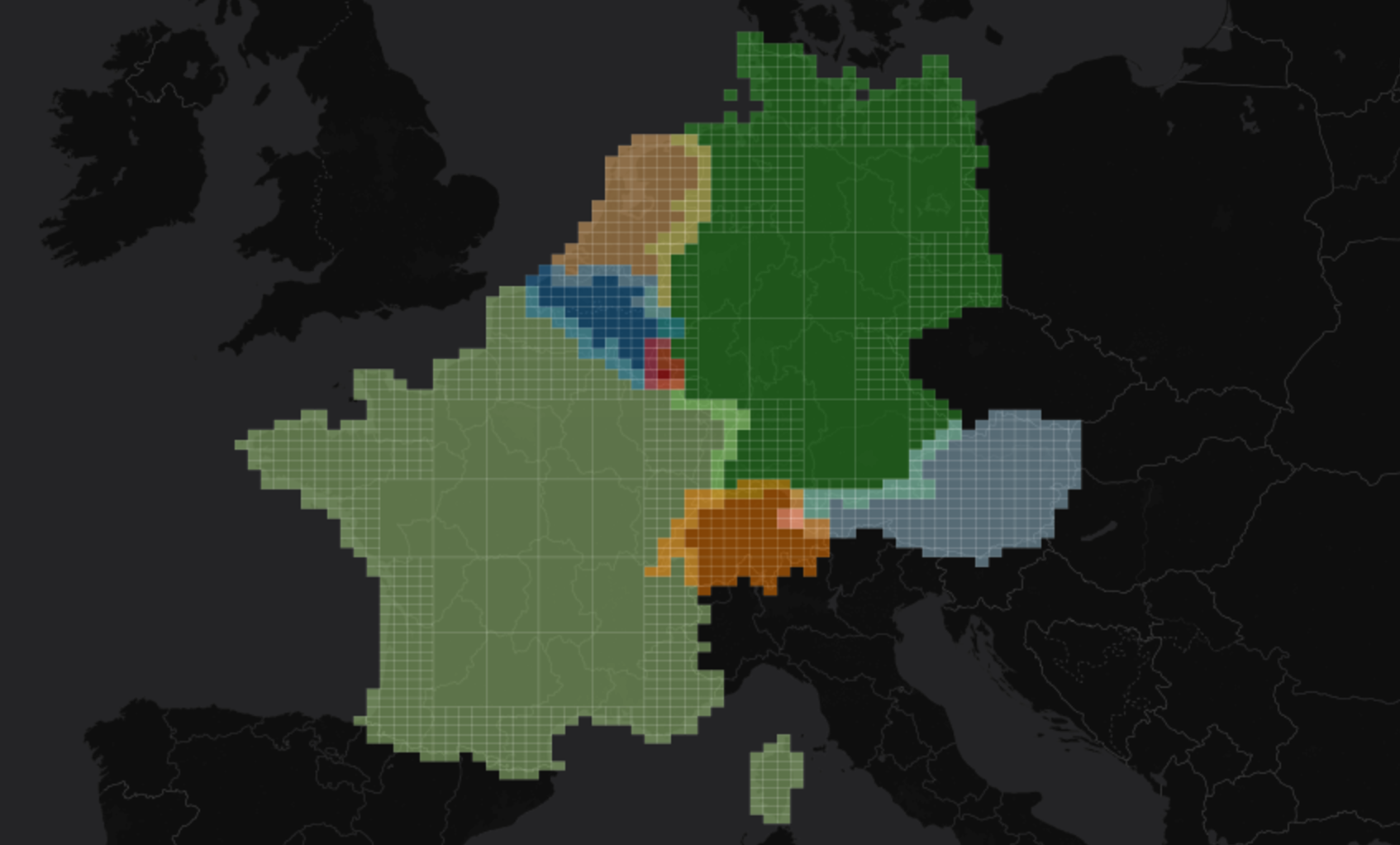
cloc is self-contained Java library able to do country localization based on geohashes.
The project puts together discretized borders in a trie data structure.
Gradle
compile 'io.github.adrianulbona:cloc:0.3.2'
Maven
<dependency>
    <groupId>io.github.adrianulbona</groupId>
    <artifactId>cloc</artifactId>
    <version>0.3.2</version>
</dependency>
Code sample - Java
final CountryLocator countryLocator = CountryLocator.create();
final List<String> countries = countryLocator.locate("u10hb1"); // ["United Kingdom"]
Code sample - Scala - Spark
val locator = spark.sparkContext.broadcast(CountryLocator.create())
val locate = udf { (geohash: String) => locator.value.locate(geohash).asScala }

val pointsDF: DataFrame = Seq(
  Point("u10hb1", 51.47, 0.00),
  Point("u33ff3", 52.52, 13.81)).toDF

pointsDF.withColumn("countries", locate($"geohash"))
  .show()

// +-------+-----+-----+----------------+
// |geohash|  lat|  lon|       countries|
// +-------+-----+-----+----------------+
// | u10hb1|51.47|  0.0|[United Kingdom]|
// | u33ff3|52.52|13.81|       [Germany]|
// +-------+-----+-----+----------------+
Sources
Feel free to come with suggestions, the source code can be explored at github/adrianulbona/cloc.